Welcome to CityRunTours.com
 Have you ever been traveling for a race, business, or just on vacation with the family, and really wanted to go for a run? Ending up in the hotel gym on the treadmill after a day of work or sight seeing is an unappealing alternative to running outside. Wouldn’t you rather be able to get in a run around the city you are visiting; one recommended by a local runner. Would you like to know about the sites you are running past, so that you can get in some sightseeing and your run at the same time?
CityRunTours are local runs, including fun facts and information about the sights and attractions you will be running past. The tours are written be a runner that has lived and run in all the locations included on CityRunTours.com. The advantage of having a local runner writing the tours is that you can get in a run that has taken into account many of the factors that can either make or break a run: pedestrian traffic, hills, water fountains, etc. You may even get some insider tips on local spots to check out after your run….
Runs will be added on a regular basis, so be sure to check back for the most up to date runs in your next destination.
Happy Running!
Erin, Founder of CityRun
Visiting San Francisco? Check out our Live San Francisco Running Tours!
California Running
Over the past month or so I’ve been traveling around California and enjoying the wonderful and varied landscape the state has to offer. Here’s some great places to run and check out around California!
Little River State Beach
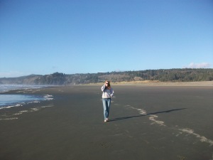 This beach is located about a 5 hour drive north of San Francisco and 1/2 hour drive south of Redwood National Forest off of the 101.
Hardly anyone is here except a couple people walking dogs. This is a great wide-open beach with sand dunes, awesome for a quick run. Easy Parking available until sunset. Read more…
San Francisco: Embarcadero and Coit Tower
San Francisco: Embarcadero and Coit Tower
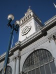
Start: Ferry Building; Embarcadero and Market St.
Access: Embarcadero Station; Any Muni Line
Distance: 3.4 miles
Water Fountains: 3
Restrooms: 3
Terrain: Flat with one Large Hill
Starting in front of the Ferry Building you will run north along the water.
San Francisco Run – Western Golden Gate Park
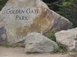 San Francisco: Western Golden Gate Park
Start: Great Highway & Lincoln Way
Access: Public Transit: N-Line, #71
Distance: 5.3 miles [up to 6.5 miles]
Water Fountains: 5
Restrooms: 4
Terrain: Small Hills
Ocean Beach
Pedestrian Traffic: Medium
Running north along the park you will see Ocean Beach to the west. This beach lay mostly undeveloped on the western most part of what was originally known as the Outside Lands by San Franciscans. In 1884 a railroad was finally built to bring citizens to the beach. San Franciscans could find much entertainment out here around the turn of the century, including the Ocean Beach Pavilion which held dances and concerts, as well as an amusement park and the Cliff House. Read more…
Boston Run: Commonwealth Ave.
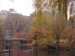
Boston Public Garden
Copley Sq – Mass Ave – Commonwealth – Boston Garden – South End

Boston Public Garden
Starting Point: Copley Sq.
Access: Green Line: Copley Sq. Stop
Distance: 3 miles
Water Fountains: 2
Restrooms: 1
Copley Sq.
Pedestrian Traffic: Medium
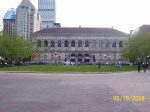
Beginning in Copley Sq. front you will run West on Boyleston St. toward the Boston Public Library.
Copley Sq. is named after John Singleton Copley. Copley was born in Boston in 1738, and became known for his

Boston Marathon Finish Line
portraits of middle class New Englanders. Many of his pieces can be found the Museum of Fine Arts in Boston. Read more…
San Francisco – Inner Sunset Start
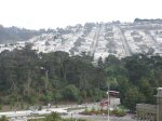
View of the Inner Sunset from the deYoung Tower
San Francisco: Inner Sunset – Panhandle – Golden Gate Park
Starting Point: 9th Ave & Lincoln Way
Access: Public Transit: #71, N-Judah, #6, #43, #44
Distance: 4 miles
Water Fountains: 4
Restrooms: 4
Starting at 9th & Lincoln run east on the south side of Lincoln Way.
Inner Sunset
Pedestrian Traffic: Light
You are running in the Inner Sunset neighborhood of San Francisco. The area was generally developed around the turn of the century when residents of San Francisco began moving westward with the construction of Golden Gate Park and the California Midwinter Fair held in 1894 in the park. Read more…
Boston Run – Copley Sq. Start
Copley Sq. – Hatchshell – Longfellow Bridge – MIT – Harvard Bridge – Commonwealth (3.53 mi.)
Run Start: Copley Sq.
Access: Green Line: Copley Sq. Stop
Distance: 3 miles
Water Fountains: 2
Restrooms: 1
You will begin your run in Copley Sq. in front of the Boston Public Library. Run north on Dartmouth St., the street running in front of the library. Run straight until you reach Beacon St. Read more…

